


Educational and methodical work
Information about educational and methodological support 620100 "GDZ", 520500 "KiG"
Teachers' Report
Round tables, seminars, trainings on changes and additions to the RUP
Master's degree documents
- PP Orders
- Expert opinion
- NPC's Diary
- The PROGRAM of the entrance test for applicants to the magistracy in the direction of 520500
- The PROGRAM of the entrance test for applicants to the magistracy in the direction 620100
- Dissertation topics
- Orders on the enrollment of undergraduates from 2019.
- Orders on the enrollment of undergraduates from 2016 to 2022.
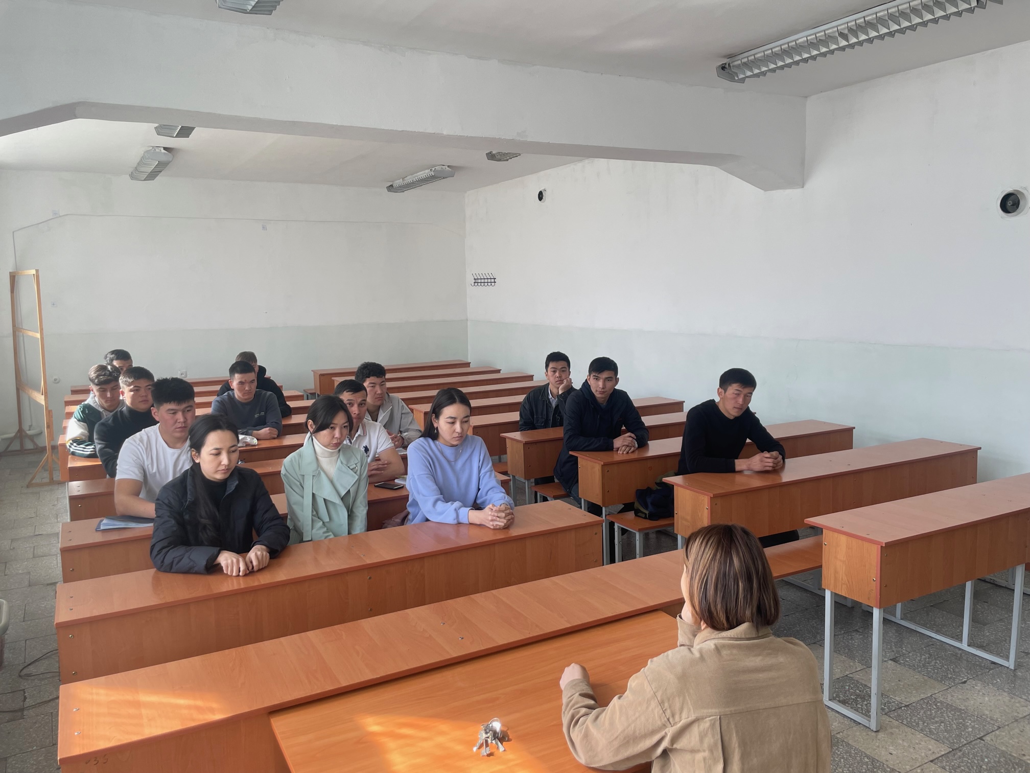
Career guidance work with undergraduate graduates to recruit groups for the Master's Program of GDZ and KiG

Classroom Fund of the Department of Geodesy and Geoinformatics
Currently, the department has a laboratory "Engineering Geodesy" - rooms 112 and 116, "GIT laboratory" - room 114, "Photogrammetry and Cartography" - room 113, where students and undergraduates of the directions "Geodesy and remote sensing", "Cartography and Geoinformatics", and students of other specialties of KSTU.
The Department of Geodesy and Geoinformatics is provided with computers and other office equipment according to the requirements of the State, there are more than 50 computers, 3 servers, 3 projectors, 6 laptops, 2 scanners, 4 printers. All computers of the department have special software packages for educational and scientific activities in the field of geodesy and geoinformatics, as well as for construction, such as: ArcGIS 10.8, pix4dapper, eMotion, Agisoft Metashape Professional, Pix4D, Google Earth Pro, Geomedia, Mapinfo, AutoCAD, QGIS, SketchUp, Trimble Business Center, R and RStudio, ENVI, ArcGIS PRO, ArcGIS online, ArcGIS StoryMaps, Survey123, Living Atlas, Field Maps, QuickCapture, etc.
Material and technical base
Currently, the department takes an active part in the implementation of international projects, such as DEvision project - Digital connection of real and virtual environments 2022-2025 and ERASMUS+ CBHE PROJECT: 617695-EPP-1-2020-1- ES-EPPKA2-CBHE-JP “Development of interdisciplinary postgraduate education programs and strengthening of research networks in the field of geoinformation technologies in Armenia and Kyrgyzstan” (GeoTAK), 2021-2024. The department also participated in the implementation of international projects Erasmus+, Erasmus Mundus, TEMPUS, USA CRDF projects, Volkswagen Foundation, participant of projects USAID, GIZ, UNEP, ADB, WB, TEMPUS, PALM, InWEnt, DAAD, ADB, UNISDR, etc.
Currently, the Austrian-Central Asian Center for Geoinformation Sciences and the Kyrgyz Center for Geoinformation Systems operate on the basis of the department - room 115.
The Austrian-Central Asian Center for Geoinformation Sciences was established in 2008 to establish and strengthen ties between Austria and the Central Asian countries for the joint development of opportunities, to stimulate information exchange and promote education and research, and it plays an active role in promoting public awareness and the widespread use of modern geoinformation technologies in Central Asia. The Center is engaged in remote training of GIS masters for Central Asian countries together with the GIS Center and the University of Salzburg (Austria). After graduation, graduates of this Center receive master's degrees from the University of Salzburg and KSTU.
The Kyrgyz Center for Geoinformation Systems (KCGIS) was established in 2006 as a state institution to meet the needs of Kyrgyz universities, research institutes and enterprises and coordinate the introduction, teaching, application and development of geographic information science and technology.
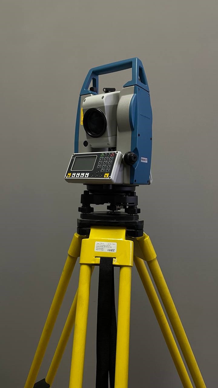
Electronic total station Spectra Precision FOCUS 2
The Spectra Precision brand
FOCUS 2 Series
Angular accuracy 5"
Optical Centering
Magnification of the telescope 30x
The measuring range of the prism is 6.25 cm to 4,000 m
Measuring range without reflector up to 500 m
The accuracy of the prism measurement is ±(2+2 mm/km x D) mm
Measurement accuracy without a reflector ±(3+2 mm/km x D) mm
The measurement speed of the prism in the exact mode is 0.3 s
Field of view angle 1°30’
Resolution 3"
Minimum focusing distance 1.0 m
Laser pointer coaxial, red
Operating time when measuring angles and distances after 30 seconds to 13 hours
The speed of measurement on the prism in the standard mode is 0.2 s
, the minimum measured distance is 1.0 m without a reflector, 2.5 m on the prism
Compensator operating range ±3’
Memory 10,000 rows
Interfaces RS-232C, Mini-USB, SD card slot
NiMH battery, 6 V
Operating temperature -20°C to +50°C
Dust and moisture protection IP5

The Trimble C3 electronic total station is used for topographic, cadastral survey and center work of various types.
Trimble brand
Trimble C3 Series
Angular accuracy 5"
Optical Centering
Magnification of the telescope 30x
The measuring range of the prism is 6.25 cm to 4,000 m
Measuring range without reflector up to 800 m
The accuracy of the prism measurement is ±(2+2 mm/km x D) mm
Measurement accuracy without a reflector ±(3+2 mm/km x D) mm
The measurement speed of the prism in the exact mode is 0.3 s
Field of view angle 1°30’
Resolution 3"
Minimum focusing distance 1.0 m
Laser pointer coaxial, red
Operating time when measuring angles and distances after 30 seconds to 13 hours
The speed of measurement on the prism in the standard mode is 0.2 s
, the minimum measured distance is 1.0 m without a reflector, 2.5 m on the prism
Compensator operating range ±3’
Memory 10,000 lines
Interfaces RS-232C, Mini-USB, SD card slot
NiMH battery, 6 V
Operating temperature -20°C to +50°C
Dust and moisture protection IP55

Electronic Total station Leica TCR802 geodetic equipment manufactured by Leica Geosystems AG, Switzerland, is known in professional circles and is widely used in the geodetic industry. In the field of conducting survey or reconnaissance activities, accuracy and speed of data acquisition are important.
Leica brand
Leica TCR802 Series
The minimum distance is 1.7 m.
Grid of threads with backlight
Compensator system Electronic 2-axis liquid compensator
Compensator operating range +/- 4'
The accuracy of the compensator installation is 2“
Measurement up to GPR1 prism (Leica)3500 m (1 prism)/ 5400 m (3 prisms)/7000 m (long base)
Measuring on the hearth (60 mm x 60 mm) 400 m
Accuracy (accurate/fast/tracking) 2mm +2 ppm/5mm + 2 ppm/5mm + 3 ppm
Measurement time (accurate/fast/tracking) 1 s / < 0.5s / < 0.3 s
Non-reflective measurements 170 m
Accuracy (fast/tracking) 3mm + 2 ppm/ 5mm + 2 ppm
Measurement time (fast/tracking) (3s + 1s/ 10m)/ (1s + 0.3 s/ 10m)
Internal memory of 15,000 data blocks
Operating temperature range -20°C to +50°C
Dust and moisture protection (IEC529) IP54
Storage temperature range -40°C to +70°C
Weight (device/battery/tripod) 4.2 kg / 0.2 kg / 0.6 kg
The number of measurements of GEB121 lines is not less than 9,000
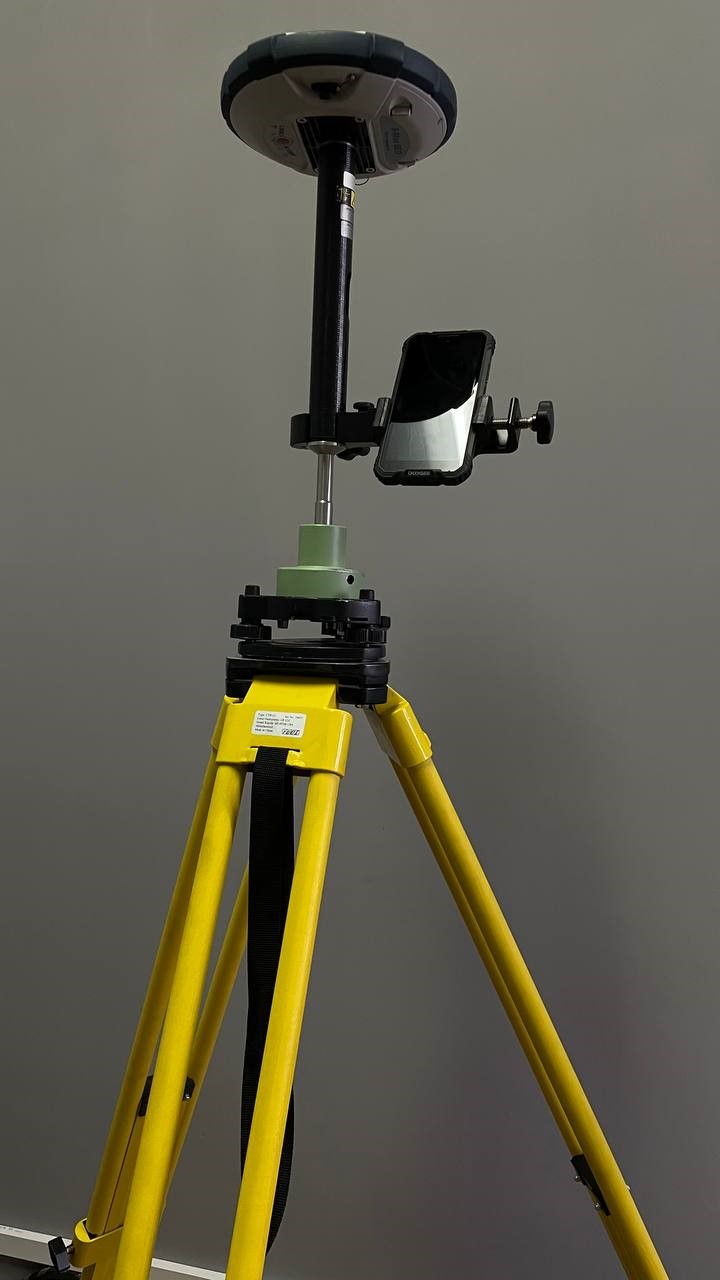
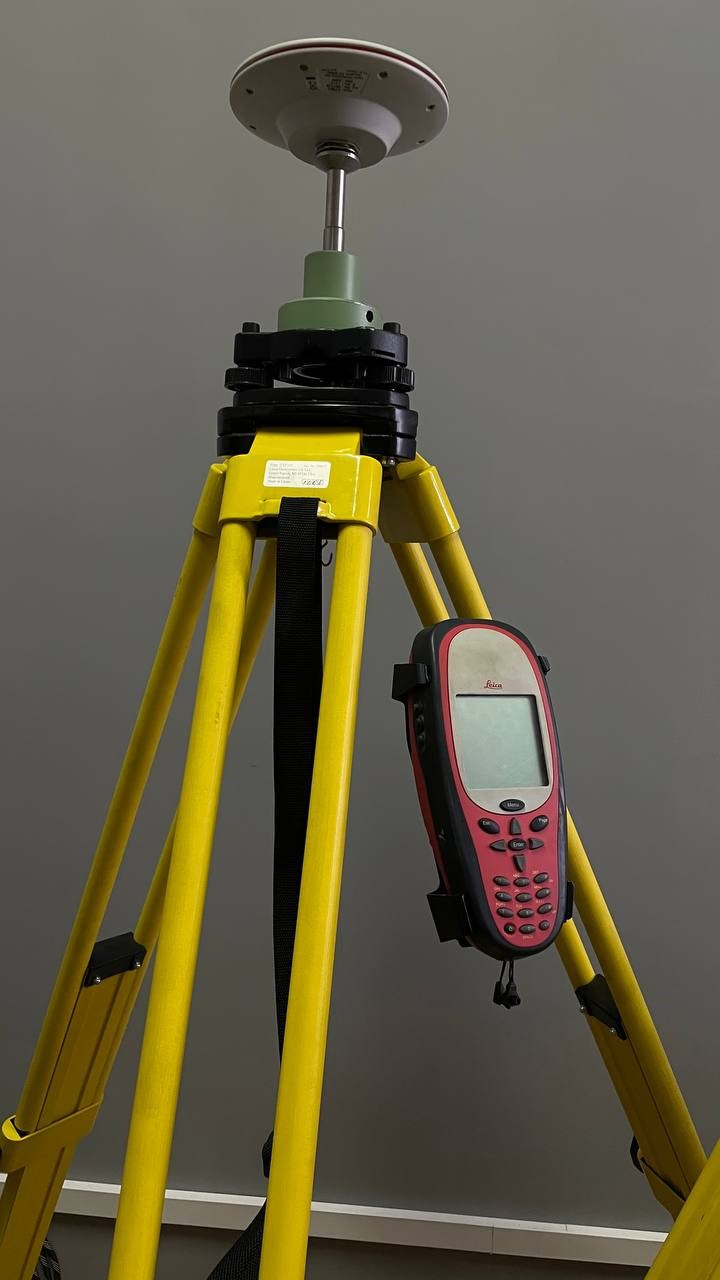
GNSS receiver S-Max GEO
It works with signals from all satellite groupings and differential correction systems – GPS, GLONASS, BeiDou, Galileo, QZSS and SBAS
Rusnavgeoset brand
S-MAX Geo Series
GLONASS: L1 C/A, L2 C/A, L3
GPS: L1 C/A, L1P (Y), L2P (Y), L2C
Galileo: E1, E5b
BDS (BeiDou): B1 (phase 2), B2
QZSS: L1 C/A, L2C, L1 SAIF
SBAS: (WAAS/EGNOS/MSAS/GAGAN) L1 C/A
L-Band Systems: CenterPoint RTX
High precision static, in terms of: 3 mm
High precision static, height: 3.5 mm
Static and Fast static, in terms of: 3 mm
Static and Fast static, height: 5 mm
Kinemat. RTK shooting from a single station, base up to 30 km, in plan: 8 mm + 1 mm/km
Kinemat. RTK shooting from a single station, base up to 30 km, height: 15 mm + 1 mm/km
Trimble CenterPoint RTX , in plan: 4 cm
Trimble CenterPoint RTX , height: 9 cm
Convergence time: 30 min or less
Information transmission frequency: up to 10 Hz
USB: USB 2.0/UART and USB OTG
Bluetooth: 2.1 + EDR, long range: Class 1 (19 dBm)
Power supply: Li-ion battery, 7.4V, 2600 mAh
Working time: 10 hours (UHF modem reception is off); 8 hours (UHF modem reception is on)
Memory: 256 MB of built-in NAND Flash memory to save more than 1 month of recording GNSS measurements with a frequency of 15 seconds from
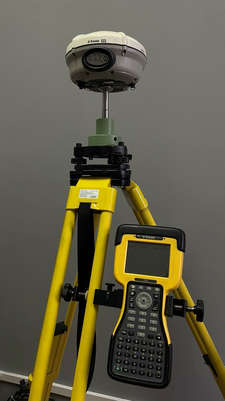
The Trimble R6 dual-frequency geodetic GPS/GLONASS receiver is an effective device for determining the location with high accuracy
Trimble brand
Trimble R6 Series
GNSS FEATURES
Number of channels 220
Satellite systems GPS, SBAS,
GPS L1C/A, L1C, L2C, L2C, L5
SBAS L1C/A, L5 (WAAS, EGNOS, GAGAN)
Data refresh rate up to 10 Hz
GNSS TECHNOLOGIES
Static, fast static 3mm+0.5ppm / 5mm+0.5ppm
High-precision static 3mm+0.1ppm/ 3.5mm+0.4ppm
RTK Accuracy 8mm+1 ppm / 15mm+1 ppm
RTC initialization is usually <8 seconds
Initialization reliability >99.9%
RTCM 2.1, 2.3, 3.0, 3.1
CMR CMR+, CMRx
Output of other GSOF, RT17, RT27 messages
Memory 11 MB
Power consumption <3.2 W in RTK rover mode with radio modem and Bluetooth enabled
Battery Li-ion battery 7.4V, 2.8Ah
Battery life rover by radio up to 5 hours, base by radio up to 2.5 hours, rover by cellular modem up to 4.7 hours
The SR20 single-frequency satellite GPS receiver from Leica Geosystems will serve to solve many field tasks related to the high-precision determination of the location of objects, whether it is the determination of the coordinates of reference points, the creation and condensation of a planned high-altitude justification, topographic surveys, land management work, etc.
Leica brand
Leica SR20 Series
Number of channels 12 (L1 carrier code/phase, SBAS support)
Operating range (recommended) up to 20 km (base length)
Measurement accuracy in plan (static) 10 mm + 2 mm/km
Height measurement accuracy (static) 20 mm + 2 mm/km
Measurement accuracy in plan (differential) 10 mm + 2 mm/km
Accuracy of height measurements (differential) 20 mm + 2 mm/km
Memory up to 2 GB (CompactFlash)
LCD screen (monochrome, 240x240 dots, with backlight)
Keyboard Alphanumeric keyboard (abbreviated)
240MHz RISC processor
Data transmission RS232, Bluetooth
Antenna internal Leica AT575 (external Leica AT501)
IP54 protection (can withstand a fall from a height of 1.2 m)
Power supply batteries (Li-ion, 7.2 Volts, 2100mAh)
Weight 0.652 kg
Operating temperature from -20C to +50C.
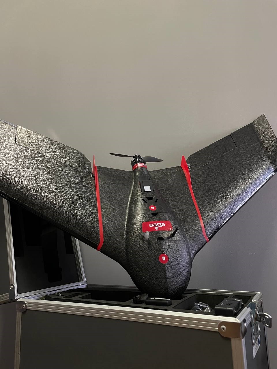
Geodesic drone of the airplane type from the Swiss company senseFly is a cartographic unmanned aerial vehicle (UAV) of the airplane type. It is lightweight, hand-launched and helps surveyors and GIS specialists to safely and efficiently obtain the necessary aerial photography data using a set of special cartographic cameras. Using photogrammetric software, for example, Pix4Dmapper, the initial data obtained by the drone can be used to create high-quality digital terrain and terrain models, detailed orthophotoplanes, three-dimensional point clouds, stereo vectorization, etc.
FIXAR brand
senseFly eBee Series
Wingspan 96 cm
Takeoff weight 630 grams
18 Megapixel digital camera, built-in
Li-Polymer Battery
Flight time 50 minutes
Heading speed 36-57 km/h
Wind resistance Up to 45 km/h
Communication by radio channel Up to 3 km.
The shooting area is from 1.5 to 10 sq. km.
Landing method Automatic rectilinear landing
Software for flight planning and control of the eMotion 2 UAV
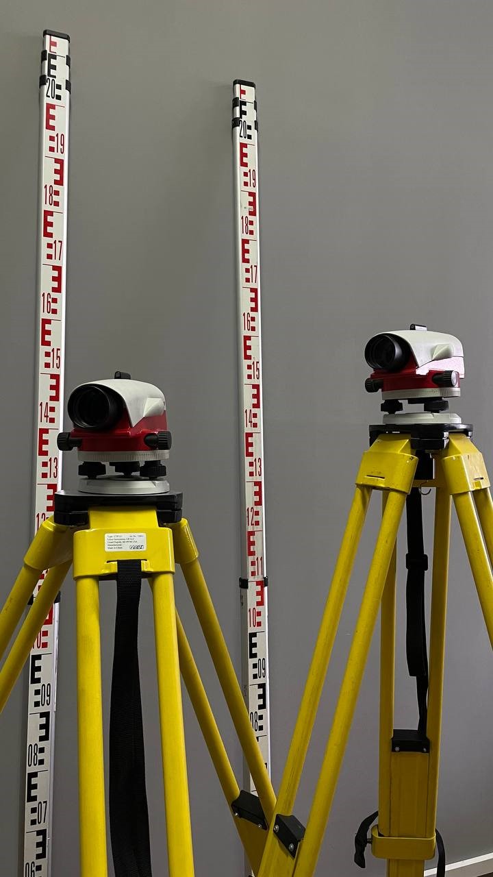
The Leica NA720 optical leveler is a professional device for leveling and monitoring construction works
Leica brand
Leica NA720 Series
Leveling accuracy (error) ± 1.2 mm
Telescope (magnification multiplicity) 30x
The telescope (image) is straight
Telescope (min. focusing distance) 0.7 m
Telescope (illuminated optics) yes
Sight tube (filling the pipe with gas) yes
Compensator (type of compensator) magnetic
Compensator (operating range) ± 15'
Dust and moisture protection IP57
Operating temperature range from -20°C to +50°C
The weight of the device is 1.7 kg
The dimensions of the device are 210x120x120mm


